As an EPA contractor I had access to areas that few others did; most notably the lower 9th ward of New Orleans. I took literally hundreds of photos during my deployment, but have held off posting them until now for obvious reasons.
Some of the pictures are very low quality because we were advised to carry only disposable cameras (people were being robbed and beaten for their digital cameras in the days immediately following Katrina). I apologize.

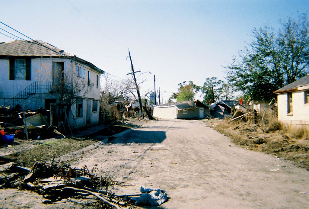
Here's what I saw as I entered the lower 9th ward for the first time. The place was a mess, downed powerlines everywhere.
One of the innumerable houses that had floated off its foundations and ended up somewhere else. This one was blocking a road we needed to get down.

Another road block. It took us several hours to pick our way through only a few city blocks. Note the water level lines on the back of the stop sign.
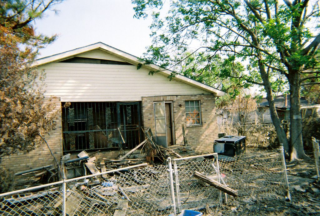
This is creepy. Every structure in the greater New Orleans area was searched in the days following Katrina. Search crews spray painted large X's, forming 4 quadrants, on the surface of each structure as they left. In each quadrant they recorded specific search information (Unit designation, date searched, etc.). The bottom number always indicated the # of bodies found within the structure. If you look hard, you can see a 9 painted in the bottom of the orange
x, on the window. Apparently 9 bodies were recovered from this house.
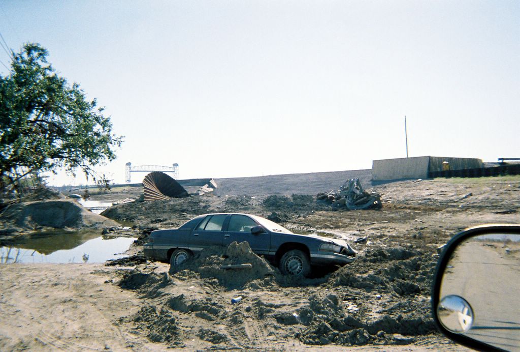
Here, above the car, is one of the main levy breaks on the industrial canal.
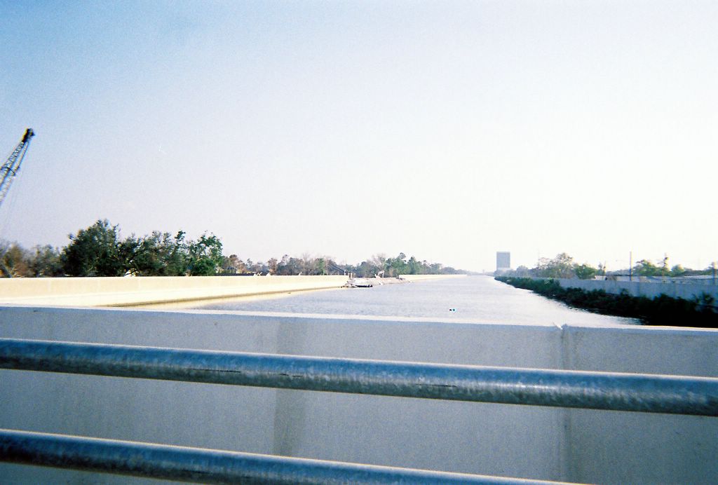
In the distance you can see the break in the 17th street canal.
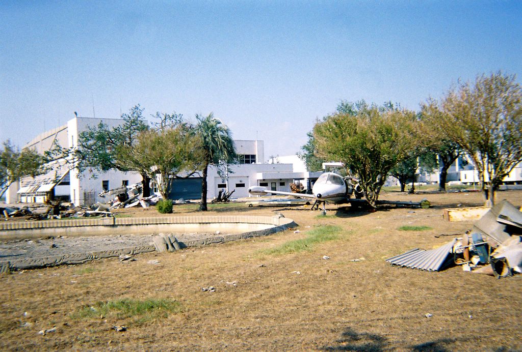
This was the scene at the municipal airport on the south shore of Lake Pontchartrain. The winds coming off the lake were strong enough to pick these planes off the tarmack and set them down a half mile away. The larger plane in the foreground was a 5 to 10 million dollar private jet.
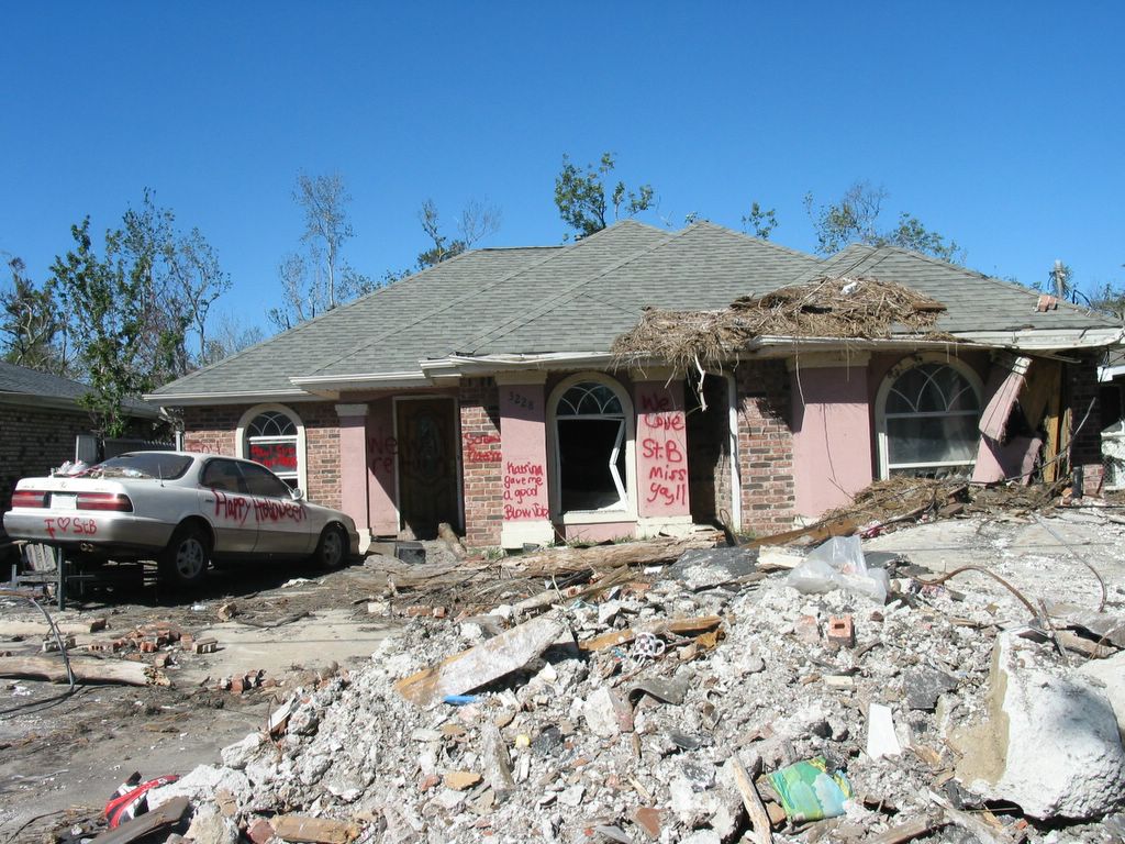
This was taken in St. Bernard Parish. Read the grafitti on the front of the house.
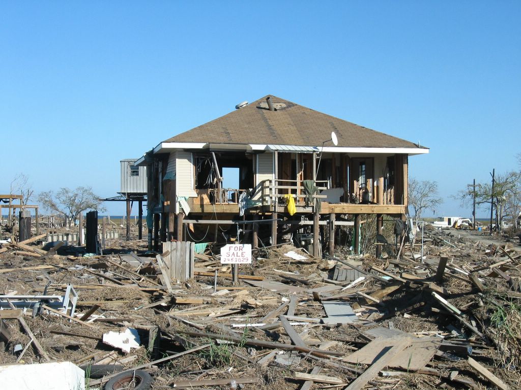
This was taken near Ft. Pike, on a narrow little swatch of land between Lake Pontchartrain and the Gulf of Mexico. The storm surge here was unreal...20 feet plus. These people never had a chance.
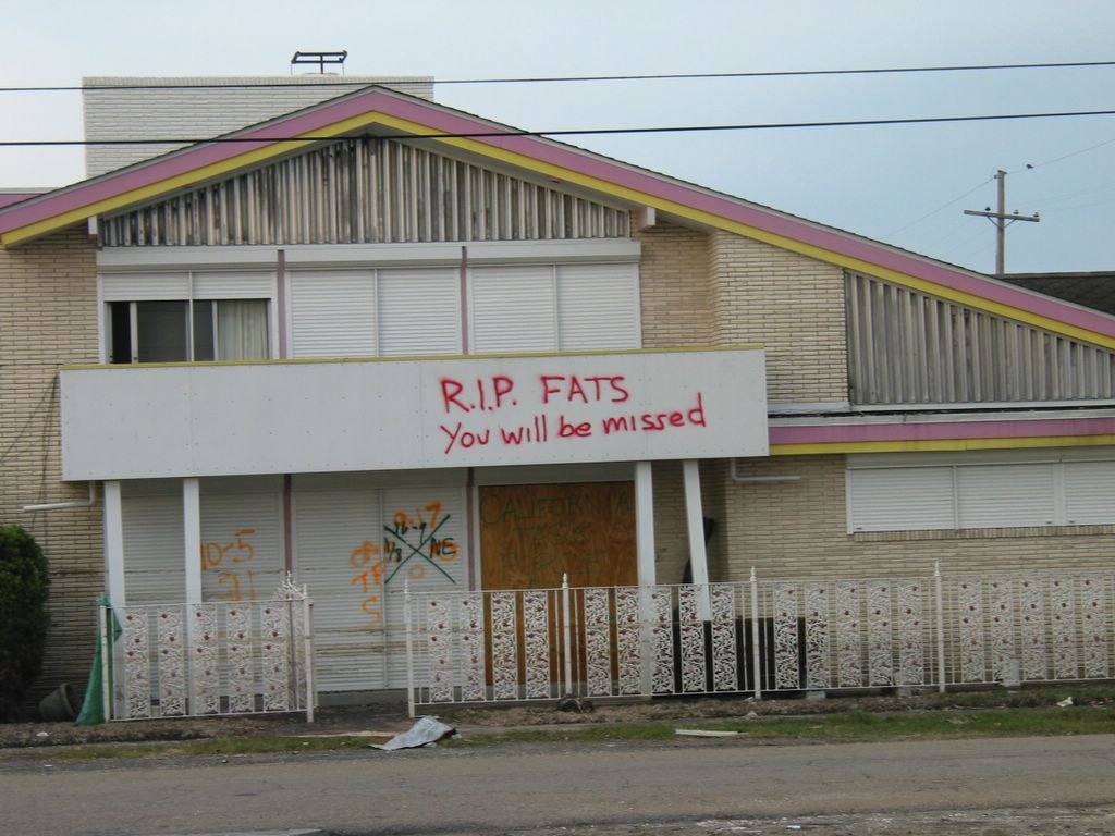
This is blues singer Fats Domino's house in the lower 9th ward. He was thought ot have perished in the flood water that destroyed most of the other structures in the area, but, apparently he had fled before the storm. Smart man.
Like I said, I have literally hundreds of pictures of post-hurricane Southern Louisiana. I'll post more sometime. Perhaps I'll post some of the pictures I took of Bayou country. Ahh...Jambalaya.

No comments:
Post a Comment