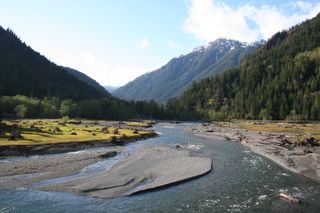
Port Townsend was everything we'd ever been led to believe it was, and then some. Charming, quaint, scenic, historic (the history of Port Townsend is fascinating), you pick the adjective. Add to these crowded, touristy, pretentious, expensive, and you begin to get a feel for the place. The whole thing is cute as a button (damn, did I really just use the phrase "cute as a button?"), and they know it. It's sickening. Shauna loved it!.
We pulled into town right about dinner time, and I was surprised at how congested downtown was for "the off-season". We wandered around for a while, touring some of the cooler Victorian aged homes and buildings, looking for someplace to eat. We decided on a bar and grill called "Finns", but, decided against it after being informed of the 2 hour wait to be seated. Instead, we walked across the street to "The Public House", another bar and grill, with the rest of the plebians. The food was alright, if not more expensive than I would have expected from a dining establishment making overtures to the common folk. After dinner, we found a cheap room at the Aladdin Inn, right on the water.
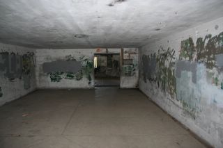
The next morning we found a laundromat, and threw Shauna's wet things into a dryer. A friendly attendant mentioned a place called Ft. Worden State Park, where she alleged there was a really well preserved WWII vintage bunker that they still let you wander through. Naturally, instead of reading women's magazines next to a row of noisy dryers for an hour, I suggested we check it out.
The attendant's description turned out to be vastly understated. What we found was an elaborate system of bunkers, tunnels, war rooms, barracks, big gun emplacements, etc., overlooking the Puget Sound. Here's just a few of the photos we took there.
The place was a labrynth, and we spent better than an hour getting ourselves lost. We could have stayed there all day. But, alas, we had a schedule. We'd have to adhere to it if we hoped to get around the peninsula and down the coast in the days remaing.
On the way out of the park we saw this lighthouse, and Mt. Baker some 70-80 miles in the distance. Upon our return, the attendant told us how rarely Mt. Baker is visible from Port Townsend, and how lucky we were to get pictures of it.
We had been more than fortunate with the weather thus far. It had been sunny and reasonably warm every day. I wondered how long our luck, and the weather, would hold. We'd find out in the days to come.
Monday, May 29, 2006
Wednesday, May 24, 2006
From Murhut falls we continued along the Duckabush road, up a series of switchbacks through some very tall timber (I'm guessing some of these Doug Firs were pushing 300 feet).
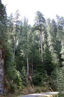
Sadly, there's no way to get a feel for just how tall these trees are without some frame of reference. Take if from Michael Finkel (my favorite adventure writer of all time) who wrote in Backpacker Magazine that "If trees could play basketball...I really think these firs could post up a redwood."
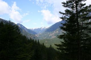
As we ascended, views of the valley opened up below us. Panoramas like this are rare in the Olympics, because the trees simply don't permit you to see very far. I like forests even better than mountains, though, so I can live with this.
That said, the peaks in the Olympics are alright too.
We climbed to a pretty respectable elevation, gawking at the old growth along the way, until a snow bank too tall to ram finally blocked our path. Defeated, we turned around and headed for the Hamma Hamma.
At first the Hamma Hamma seemed like a repeat of the Duckabush, just as the Duckabush seemed destined to be a replay of the Dosewallips. All three are variations on a theme. Narrow valleys with steep slopes, covered by dark trees. Each has a cold, swift river winding through their bottomlands to the Hood Canal, and each is as beautiful as the last.
The differences are subtle, yet tangible. Each has it's own distinctive character. What separates the Hamma Hamma from the others is the river it's self. Perhaps it was a trick of the light (there usually isn't much to be had on the Olympic Peninsula), the afternoon sun illuminating the crystal blue waters from above, I'm not sure. It just seemed to me that the Hamma Hamma River was a little more picturesque, a little more inviting than the others.
From the road we saw a sparkling little pool at the base of a small waterfall. We decided to hop out and take the short hike down to see them.
When we got there, we realized that both the pool and the waterfall were much bigger than we had thought. Because we could see the bottom of the pool from the road, we figured that it must be fairly shallow...we were wrong. The pool was easily 15 feet deep, and the falls were at least that tall. Still, despite the obvious danger, the greenish blue water and the thundering falls were irresistible, and we climbed over moss covered rocks to take some quick photos.
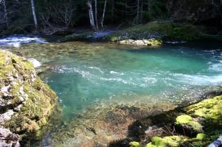
The pool...
The falls...
Shauna sitting on a moss covered boulder at the edge of the pool...
And here begins a funny tale...
Literally seconds after snapping that last pic, I ambled over and set down next to Shauna on the bank. We lie there together for awhile, I'm guessing 15 minutes or so, enjoying the scene. Inevitably, I began packing up the tripod and the camera, while Shauna stood up to go.
As she made her way across the moss covered rock, I watched her right foot slip into a 5 to 6 inch deep pool on the river; and I think to myself "Man, she's gonna' get her foot wet...I hope she packed an extra pair trail runners, or something."
Much to my (and Shauna's) suprise, the pool was more like two or three feet deep (yet again, the crazy clear river had fooled us) and I watched her sink up to her waist into the cold water. Still not particularly concerned, my mind says "ah crap, she's gonna' need to change her pants, maybe even her shirt, now. I hope we can find a place to dry them in Port Townsend tonight."
It wasn't until I saw her vanishing down the mossy bank that I realized she was in the deepest of shit. An invisible current was pulling her in quickly, and I knew I didn't have enough time to reach her before she disappeared completely. Somehow, and at the last possible moment, her left foot found something solid on the slimy rock that she clung to, and together we struggled to terra-firma.
This is Shauna immediately after the incident. Wet up to the neck, but no worse for the wear. I still have dreams of her slipping into that crystal pool, only in my dreams things don't always end so well.
Really, I was ready to pack it up, make for Port Townsend and regroup. Take the rest of the day off. Fortunatley, it took a while for Shauna to get changed. In that time I had recovered myself, and, apparently She had recovered herself too (or, perhaps she's just tougher than I am).
We continued up the road for awhile, taking pictures as we went. The sky was pale blue (we were having unreal luck with the weather), and the temps were perfect. I particularly liked the shots we got of a few mountain peaks that were usually shrouded in clouds and fog.
A few clicks up the road we were again halted by snow. And, once again we consulted our hand drawn wonder map and elected to try a road that promised to take us past Elk and Jefferson Lakes. Neither of us had any notion of what these lakes were supposed to look like, but, they seemed promising.
The road took us through some beautiful second and old growth stands of Douglas fir on our way to the lakes, and the mountain peaks became more and more dramatic as went.
Somehow, we missed Elk Lake. We didn't see a single sign for it, and we didn't see any side roads that looked like they might take us to it. We did, however, find Jefferson Lake. It was a short, steep walk downhill from the parking lot to it's emerald waters.
Jefferson Lake...
Check out how green the water is!
A creek feeding the lake.
There was a spectacular stand of old growth Doug Fir along the north shore of the lake. These were some of the tallest trees we saw on the peninsula. And we would see our share of very, very tall trees.
It was early evening as we left Jefferson Lake, so, we elected to finally move north, to Port Townsend. I can't say I wasn't a little melancholy as we passed through Quilcene, where we left the Hood Canal and the Eastern side of the Peninsula behind. I'm glad that we spent a little time there. That we didn't just blow through, en-route to the "real" attractions on the north and west sides. The Hood Canal is a back-woodsy (is that even a real word?) little gem that will always be among my favorite places.
Next up...the north side.
Sadly, there's no way to get a feel for just how tall these trees are without some frame of reference. Take if from Michael Finkel (my favorite adventure writer of all time) who wrote in Backpacker Magazine that "If trees could play basketball...I really think these firs could post up a redwood."
As we ascended, views of the valley opened up below us. Panoramas like this are rare in the Olympics, because the trees simply don't permit you to see very far. I like forests even better than mountains, though, so I can live with this.
That said, the peaks in the Olympics are alright too.
We climbed to a pretty respectable elevation, gawking at the old growth along the way, until a snow bank too tall to ram finally blocked our path. Defeated, we turned around and headed for the Hamma Hamma.
At first the Hamma Hamma seemed like a repeat of the Duckabush, just as the Duckabush seemed destined to be a replay of the Dosewallips. All three are variations on a theme. Narrow valleys with steep slopes, covered by dark trees. Each has a cold, swift river winding through their bottomlands to the Hood Canal, and each is as beautiful as the last.
The differences are subtle, yet tangible. Each has it's own distinctive character. What separates the Hamma Hamma from the others is the river it's self. Perhaps it was a trick of the light (there usually isn't much to be had on the Olympic Peninsula), the afternoon sun illuminating the crystal blue waters from above, I'm not sure. It just seemed to me that the Hamma Hamma River was a little more picturesque, a little more inviting than the others.
From the road we saw a sparkling little pool at the base of a small waterfall. We decided to hop out and take the short hike down to see them.
When we got there, we realized that both the pool and the waterfall were much bigger than we had thought. Because we could see the bottom of the pool from the road, we figured that it must be fairly shallow...we were wrong. The pool was easily 15 feet deep, and the falls were at least that tall. Still, despite the obvious danger, the greenish blue water and the thundering falls were irresistible, and we climbed over moss covered rocks to take some quick photos.
The pool...
The falls...
Shauna sitting on a moss covered boulder at the edge of the pool...
And here begins a funny tale...
Literally seconds after snapping that last pic, I ambled over and set down next to Shauna on the bank. We lie there together for awhile, I'm guessing 15 minutes or so, enjoying the scene. Inevitably, I began packing up the tripod and the camera, while Shauna stood up to go.
As she made her way across the moss covered rock, I watched her right foot slip into a 5 to 6 inch deep pool on the river; and I think to myself "Man, she's gonna' get her foot wet...I hope she packed an extra pair trail runners, or something."
Much to my (and Shauna's) suprise, the pool was more like two or three feet deep (yet again, the crazy clear river had fooled us) and I watched her sink up to her waist into the cold water. Still not particularly concerned, my mind says "ah crap, she's gonna' need to change her pants, maybe even her shirt, now. I hope we can find a place to dry them in Port Townsend tonight."
It wasn't until I saw her vanishing down the mossy bank that I realized she was in the deepest of shit. An invisible current was pulling her in quickly, and I knew I didn't have enough time to reach her before she disappeared completely. Somehow, and at the last possible moment, her left foot found something solid on the slimy rock that she clung to, and together we struggled to terra-firma.
This is Shauna immediately after the incident. Wet up to the neck, but no worse for the wear. I still have dreams of her slipping into that crystal pool, only in my dreams things don't always end so well.
Really, I was ready to pack it up, make for Port Townsend and regroup. Take the rest of the day off. Fortunatley, it took a while for Shauna to get changed. In that time I had recovered myself, and, apparently She had recovered herself too (or, perhaps she's just tougher than I am).
We continued up the road for awhile, taking pictures as we went. The sky was pale blue (we were having unreal luck with the weather), and the temps were perfect. I particularly liked the shots we got of a few mountain peaks that were usually shrouded in clouds and fog.
A few clicks up the road we were again halted by snow. And, once again we consulted our hand drawn wonder map and elected to try a road that promised to take us past Elk and Jefferson Lakes. Neither of us had any notion of what these lakes were supposed to look like, but, they seemed promising.
The road took us through some beautiful second and old growth stands of Douglas fir on our way to the lakes, and the mountain peaks became more and more dramatic as went.
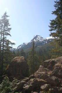
Somehow, we missed Elk Lake. We didn't see a single sign for it, and we didn't see any side roads that looked like they might take us to it. We did, however, find Jefferson Lake. It was a short, steep walk downhill from the parking lot to it's emerald waters.
Jefferson Lake...
Check out how green the water is!
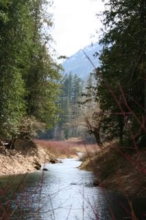
A creek feeding the lake.
There was a spectacular stand of old growth Doug Fir along the north shore of the lake. These were some of the tallest trees we saw on the peninsula. And we would see our share of very, very tall trees.
It was early evening as we left Jefferson Lake, so, we elected to finally move north, to Port Townsend. I can't say I wasn't a little melancholy as we passed through Quilcene, where we left the Hood Canal and the Eastern side of the Peninsula behind. I'm glad that we spent a little time there. That we didn't just blow through, en-route to the "real" attractions on the north and west sides. The Hood Canal is a back-woodsy (is that even a real word?) little gem that will always be among my favorite places.
Next up...the north side.
Monday, May 22, 2006
The next morning Shauna and I faced a bittersweet proposition. While the day promised to be every bit as spectacular as the last, we'd be experiencing whatever it held without Heather and Jeffery, who were leaving us for home. This sucked at so many levels. They had been cool travel partners, and they were veterans of the peninsula. They had proven a reservoir of ideas for the first couple days of our adventure, and I wondered how we would fare without them. We said goodbye to them after a particularly weak continental breakfast at the Super 8 (on what continent, I wonder, are hotel guests served only stale donuts and Sunny-D every morning? I digress.), and Shauna and I wasted little time hitting the 101 northbound.
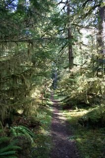
We had only planned to spend a couple days on the eastern side of the peninsula, since most of our research had led us to believe that the northern, and western sides of the Olympics were where it was really at. After having experienced Lake Cushman, Shady Lane, Staircase Rapids and The Dosewallips, though, I didn't feel like leaving the area so unexplored.
Consulting a truly stellar terrain map (seriously, this thing is a hand drawn work of art) that we had picked up at a gas station in Brinnon, we decided to take a look at the Duckabush and Hamma Hamma recreation areas before moving too far north. We tried the Duckabush first, following a road that felt very similar to the one we had taken through The Dosewallips the day before. It tracked a narrow river valley wooded by young vine maple, Red Cedar and Doug Fir.
The road turned to gravel a few miles into the trip, and we continued on it for a few miles to the Murhut Falls trailhead. We glanced over a few books and decided it might be worth the 0.8 mile slog in to see it. The first several hundred yards of the path were a little steep, but it flattened out a bit after that. The final 300 yards of the trek were all downhill. We were in no particular hurry, but we seemed to be making exceptional time through the young second growth forest of Douglas Fir. No huffing, no puffing, no overheating. At first we chalked it up to just being excited about our surroundings, but later realized that we were only hiking at about 400 feet above sea level. We live at 4800 feet. Our lungs were swimming in oxygen here.
A young Forest of Douglas Fir.
Suddenly, the forest became very old as we neared the falls. Large Red Cedar and Douglas Fir competed for space on the steep slopes, and neon green moss grew thick on every surface. For some reason the logging crews had passed over this little ravine while completely wiping out the surrounding hillsides some 40 or 50 years ago. Perhaps they thought it would be too much trouble to remove the timber from these nearly vertical slopes. Or, maybe even they were moved by the beauty of the place, leaving it intact out of admiration.
Shauna at the bottom of the ravine.
Murhut Falls
We hung out there for a long time. Hours maybe (I'm not sure...time does strange things in the these big forests and we had left our watches and phones in the car), strolling through the big timber at the edge of the creek. Shauna especially seemed to want to linger. Maybe it was the sound of the tumbling water, or the rainbow of mist that floated from out of the ether, or the feeling of complete isolation, but the place felt different than anywhere we had ever been. Like a church. Or a cathedral. Shauna later confided that of all the places we had visited together, this was her single favorite.
Again, we left this place grudginlgy, wishing we could stay longer. But we wanted to see a little more of the Duckabush, and then the Hamma Hamma. So we returned to the trail. This is one place I expect we shall visit again.
Saturday, May 20, 2006
Grudgingly, we left Shady Lane and Lake Cushman behind. We hated to put such a remarkable place in the rear view mirror, but we were determined to move on. An entire peninsula (and hundreds of miles of coast) lay unexplored before us, and I rather suspected the best was yet to come. We hopped on the 101 heading north through Hoosdport, Liliwaup, Eldon and Brinnon; a series of picturesque little towns straddling the highway along the scenic Hood Canal.
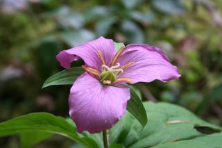
By chance we strayed from the 101 and wandered up the Dosewallips river road until it came to an unceremonious end, where it had been washed out by a flood some years prior. A sign led us to a nearby trailhead and we started up a steep footpath through a stand of second growth Douglas Fir and Red Cedar. This place felt positively open and airy when compared to the close old growth of Shady Lane. Moreover, the greens were much lighter here, lending the place a feeling of spring. Just as it had at Shady Lane, life proliferated everywhere, occupying every niche.
A new generation springing from the old.
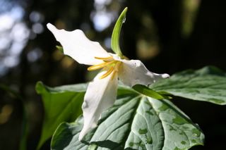
Purple Trillium...
The trail led us up, and then down a set of switch-backs to the old road beyond the washout. We followed the road, and the river for a maybe a couple miles through an increasingly old and forbidding forest.
Heather, Shredder, Killer and Aprillia.
Heather, Jeffery, me (Sterling).
Shauna.
Soon, the light was waning. The thought of making our way back through the dark in Black Bear, Mountain Lion, and most disturbingly, Sasquatch country (with three very tasty looking Yorkshire Terriers in tow) inspired us to hump it back to the truck in a fraction of the time it took us to get there.
Heather and Shredder in the half-light.
We were starving when we got to the truck. Fortunately there was the Geoduck (a little bar and grill that serves the best clam chowder in the free world) a few miles down the 101 in Brinnon. We hung there for an hour or two, eating and listening to live bluegrass. In the end, we were just procrastinating the 30 mile drive back to Shelton, and our rooms at the Super 8. Finally, we rolled out of Brinnon and down the road.
Sunday, May 14, 2006
The following day dawned clear and blue, scarcely a cloud in the sky. With the promise of good weather we all returned to the Shady Lane trailhead while the dew was still fresh on the moss, and stepped into a world I never knew existed.
Shauna and me near the trailhead.
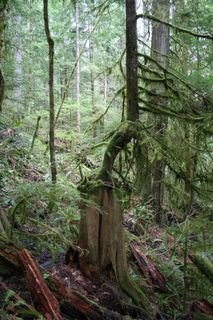
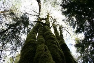
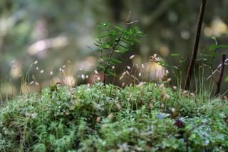
Our progress on the trail was painfully slow at first, as I found myself stopping to marvel at something every few feet along along the way. There are worlds within worlds beneath the canopy of the temperate rainforest. Life taking hold in seemingly impossible places, and revealing its self in layers to us as we took the time to look. There are miracles of beauty at every scale here, from the megalithic trees to the micro-plants whose natural range is limited to perhaps only a few square miles of this forest floor. Here's a poor sampling of what we saw.
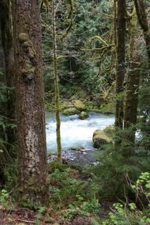
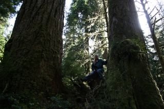
Finally we reached the bridge at Elk Creek, and the ranger station there. We tarried there for a few moments, then picked up the trail to staircase rapids. We followed this path through a stand of truly gigantic Douglas Firs and Western Red Cedars, and past crystal green pools on the tumbling upper Skokomish river.
The trail ended abruptly about a mile from the ranger station, at a washed out bridge. A little bummed out we turned around and started back for shady lane.
Much, much more to come...
Everyone has their own unique vision of paradise. To some, paradise is a tropical beach with white sand, a hammock between palm trees, and a fruity drink in each hand. To others, it's red rock canyons and blue sage brush as far as the eye can see. I've always envisioned paradise as an ancient forest with immense trees and wide rivers, snow capped peaks on every side, and inhabited by wild and dangerous creatures.
Though I didn't know it, I had never fully realized paradise in any of my travels. Despite having spent considerable time in some of the most spectacular forests on the planet (namely The Redwoods and Sequioa National Parks), I had never experienced anything like what I recently discovered on the Olympic Peninsula in northwestern Washington State. There lie forests like no other remaining on earth, where Sitka Spruce, Douglas Fir and Western Red Cedar grow to epic proportions and battle one another for woodland supremacy. Where rainfall is measuerd in feet instead of inches, and the whole world, it seems, is draped in moss or covered by giant ferns. Where glacier tipped mountains rise from the ocean like emerald titans and break themselves against the sky. Paradise, indeed.
Shauna and I had been talking about a trip to the pacific northwest for quite some time. We decided that following the 101 around the Olympic Peninsula then down the Washington and Oregon coast would be a good way to sample what the region had to offer. Then, if we had time, we thought we might make our way across the Wilamette Valley, and into the cascades. This was our proposed route.
We flew into Portland, picked up a rental (a surprisingly capable Ford Escape with 4 wheel drive), and headed north along I-5. A few hours later we joined the 101 in Olympia, and continued north to Shelton where we met my sister, Heather, her husband, Jeffery, and their three little dogs. We decided we would all pile in the Escape, make our way towards Lake Cushman and the Skokomish River and see what we could see. I had read about some cool day hikes in the area and I had hoped we could find some of the trailheads in preparation for the following day.
Lake Cushman is beautiful, huge (by Utah standards), and surrounded by big timber and green mountains. The sky was mostly clear ( apparently very rare for early april), and the air was crisp. . . perfect.
A view from the north shore of Lake Cushman.
We drove along the North Shore of Lake Cushman, crossing the bridge where the Skokomish River enters the lake.
This was taken from the bridge over the Skokomish River. The boundary of Olympic National Park is clear where the smaller, lighter green trees in the forground meet the darker, older timber.
We kept driving until we reached the shady lane trailhead. We dedcided we didn't have enough daylight to attempt the hike, so we saved it for the next day and started back to Shelton along the North shore of Lake Cushman. From the road we spotted a little waterfall and snapped a few photos of it. A couple of them turned out alright...
From the falls we headed back to Shelton, and spent the night there.
More to come...
Subscribe to:
Posts (Atom)