Wednesday, January 31, 2007

Yellowstone, Day 2...

I’ve never been particularly keen on horses. I’ve seen way too many clips of riders being tossed like rag dolls from the backs of their equine pals to ever feel truly comfortable on one.

Needless to say I was a little nervous about our impending expedition. It seemed cool in the abstract…Shauna and I riding cowboy style through the world’s first national park…the reality of it suddenly didn’t seem like so much fun as we sat through our pre-ride safety meeting, though.

If I was nervous before, I was positively concerned when one of our guides introduced me to what had to be the single biggest saddle horse on this or any other planet. It was twice as wide, and several hands taller than any of the other horses in our group. I was told that this monstrous thing was some sort of “half draft” (half Belgian draft horse, half quarter horse), and that his name was “Ugg”. I was assured that despite his freakish size, he was the tamest horse of the lot, and that if we ran into a grizzly he’d be the horse I wanted to be riding (apparently he never spooked, and bears would often turn tail and run at the very sight of him).


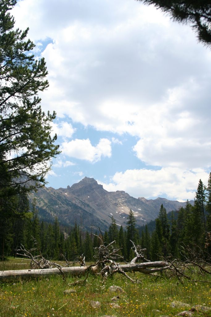
It was another perfect morning, and soon we were making our way through some of the most pristine country in the park. It took a few minutes to get used to the idea of being there, astride a behemoth, but the scenery seemed to take the edge off. We rode across lush meadows, and through impressive stands of Douglas fir. There’s no doubt we’d have seen all kinds of wildlife if it hadn’t been for one of our guides…this girl let her mouth run the entire 2 hours we were on the trail. She went on and on about horses and dogs and bears and her boyfriend and her girlfriends and her hometown…good hell! I felt like I had to feign interest to avoid being rude, but I was probably only encouraging her. I should have just told her to shut it.

That was my only complaint, though. Ugg was brilliant (what a big, gentle, flatulent animal) and the scenery around Tower and Roosevelt was classic. I’ll never visit the Yellowstone area again without doing something like this. It’s the best way for a lot of people to leave the crowds and the traffic behind…actually get into the back country. A google search brings up links to guide services both inside and outside of the park. We plan on taking a multi-day tour next time.

From Roosevelt we headed south, for Yellowstone Lake. The road climbed gently along Antelope Creek, then followed a long ridge across the western flank of Mt. Washburn. Views of the Antelope Creek drainage opened up, and people were parked along the road with binoculars and spotting scopes, peering into the valley below.

We stopped and asked one gentleman what they were all looking at. “Nothing,” he replied. “Nothing right now, anyway”. He explained that he and his friends had been there since before dawn, watching members of the Agate Creek Wolf Pack come and go from a den site somewhere below.

My interest was piqued. Wolves had always been among my favorite animals, but they were probably the only large North American mammal I’d never seen in the wild. We decided to hang out and glass the valley for awhile...see what we could see. I’d never done this in a place like Yellowstone before, and neither of us could believe what we had been missing. In 20 minutes we saw more large game animals than the entire rest of the trip to that point…Bison, Elk, Mule Deer, Coyote…amazing. I’d never seen that kind of wildlife density before. I had no idea there were so many animals around.

No wolves, though. The diehards said we probably wouldn’t see them again until dusk, or even the following morning when the pack set off to hunt. So, we hopped back into the truck and started south again.

Shauna thumbed through one of our trail books as we drove and decided the short hike along Pelican Creek to Yellowstone Lake sounded cool. Pelican Creek is said to be prime grizzly habitat, so we made a mess of our gear looking for our bear spray. Finally, and with two giant cans of liquid fire in hand, we hit the trail. It was only a few hundred yards along the creek, through thick stands of lodge pole pine to the shore.

The breeze coming off the water was ideal, and we hung out for awhile on the beach. A few minutes later we were back in the truck, wishing the loop had been a little longer.

Suddenly, we were feeling recovered, ambitious again...and Shauna reminded me how cool Shoshone Lake sounded.

According to the U.S. Fish and Wildlife Service, Shoshone is the largest back country lake in the lower 48. Our guide book described the scenery along its northern approach, via the DeLacy Creek Trail, as being “what many of the park’s forests looked like prior to the dramatic changes brought about by the 1988 fires”. These are the oldest stands of lodge pole pine in the park…400+ years old. Best of all it was only six miles roundtrip.

Sounded good to me…

From West Thumb we took the Old Faithful-West Thumb road to the Delacy Creek trailhead. We threw on our day packs, tossed a couple granola bars in the pockets and made south.

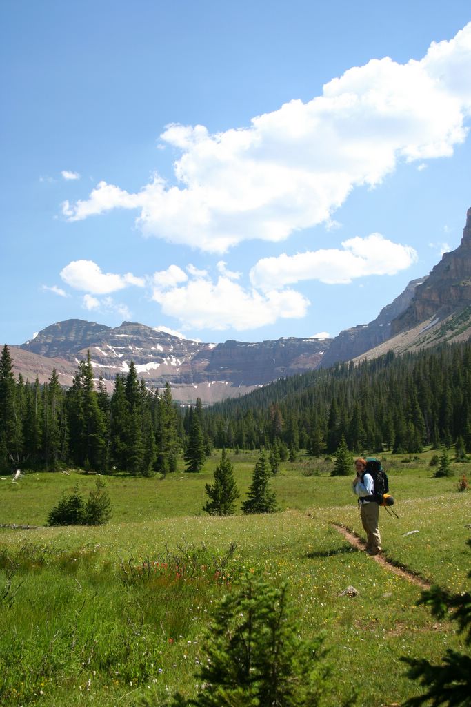
It felt good to be out of the car, and we covered a lot of ground in a really short time. The path wandered through a dark, cool old growth pine forest for the first mile and a half or so. Then it burst into some of the greenest, widest alpine meadows I’ve ever seen. Butterflies and wildflowers were thick across floor, and I expected some sort of huge ungulate to wander through momentarily.

A mother duck and her brood...

The meadows turned marshy, and the air felt tangibly cooler as we approached Shoshone. Then, all at once we were there, on the shores of a huge sapphire gem of a lake surrounded on all sides by dark timber. We were completely alone, and for just a moment I understood what those early explorers of the Yellowstone Country must have felt as they gazed across this ancient landscape for the first time.

Shoshone Lake...

We wandered down the beach for awhile, snapping photos as we went, hoping the camera would capture even a poor facsimile of what we were seeing. Finally, we found a nice piece of shade and stretched out for a moment to gather our strength for the looming hike out. Two hours later we awoke to the sound of something big crashing through the forest behind us. A massive bull elk threw his head back as he sprinted away through the trees. The cool breeze coming off the lake had acted like chloroform, knocking us out for what was left of the afternoon. The shadows were getting long across the lake, and the temperature had dropped several degrees. I knew sunset couldn’t be more than a couple hours away. It would be a race to get back to the truck before dark.

I wasn’t particularly comfortable with our present circumstances. I usually try to avoid hiking in places like Yellowstone during the early morning, and at dusk; the chances of bumping into something big and nasty on the trail increases exponentially during these hours. And suddenly the park seemed alive with sounds...a rustling of bushes next to the trail caused me to draw my can of whoop-ass from its holster, but it was just a grouse. Feeling very vulnerable as dark approached, we jogged the rest of the 3 miles back to the trailhead, arriving only minutes before nightfall.

Pulling into West Yellowstone we could scarcely believe that it was the same day that we had woken up pre-dawn do go horseback riding. It would be tough to top Day 2, but day 3 would prove every bit as cool.

Sunday, December 24, 2006

Yellowstone, Day 1...

The idea of spending four days hiking Yellowstone's back-country sounded like pure Hell to both of us. Yet, there we were at the west entrance, scarcely four days after stumbling out of the High Uintas.

We felt like we were living one of those gimmicky trip reports in backpacker magazine. You know, the ones with titles like "7 National Parks in 7 days", or "One Week, 12 Peaks". Really, what we were planning was crazy. Crazy for a couple out of shape 30 something's, anyway.

The original plot involved hiking the entire 12 mile length of the Pebble Creek Trail on day one, slogging another12 miles to Shoshone Lake via the Lewis Channel trail on day two, completing the 9 mile round trip to the Beaver Ponds near Mammoth on day three, and finally climbing 6 miles to the top of Mt. Washburn from Dunraven Pass before leaving on the fourth and final day...all this after having just endured an 18 mile puke-fest in the Utah high country.

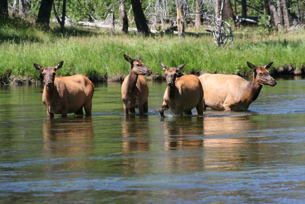
No more than five minutes inside the west gate we hit our first wildlife jam. People were abandoning their vehicles on the highway, making for the Madison River below, and traffic was completely snarled in both directions. Knowing we wouldn't be going anywhere anytime soon, we followed the crowd into the trees to see what had created all the fuss. I was expecting a grizzly sow with cubs, maybe even a pack of wolves for all the commotion. Naah...just a small group of cow elk trying to cross the river. We laughed, snapped a few pictures of the old girls in the water and moved on as soon as the mob began to break up.


Elk Cows...

The morning air was the perfect temperature, and the windows down cruise across the park, and into the Lamar Valley seemed to steal what little resolve I had to battle the rugged Yellowstone back country for the rest of the day. Pulling up to the trailhead at Pebble Creek I was still willing to give it a go for Shauna, but when she sat there motionless and glassy eyed instead of rifling through the cab for her gear, I knew it wasn't going to happen. The next few minutes went something like this:

Sterling: Are we gonna' do this?

Shauna: That's why we came, isn't it?

Sterling: Yip...let's do it!

Shauna: Let's do it!


Five Minutes later...

Sterling: Do we really want to do this?

Shauna: Sure...(yawn...stretch...).

Sterling: Alright...let's hit it!


Five minutes after that...

Sterling: We could do a shorter hike today if you wanted...see how we feel tomorrow...

Shauna: Good idea!

Sterling: Trout Lake is only one mile round trip.

Shauna: Trout Lake it is!

Yeah, we're diehards!

The path to Trout Lake ascends a steep ridge through some impressive stands of Douglas Fir. One tree in particular rivaled even some of the Coastal Doug Firs we had seen in the Pacific Northwest for sheer girth. It was a beast.

The short climb was over as quickly as it had begun. The lake was pretty, and true to its name there were big, thick trout lurking just beneath its crystal surface. We circled the lake, taking pictures as we went.


Trout Lake...


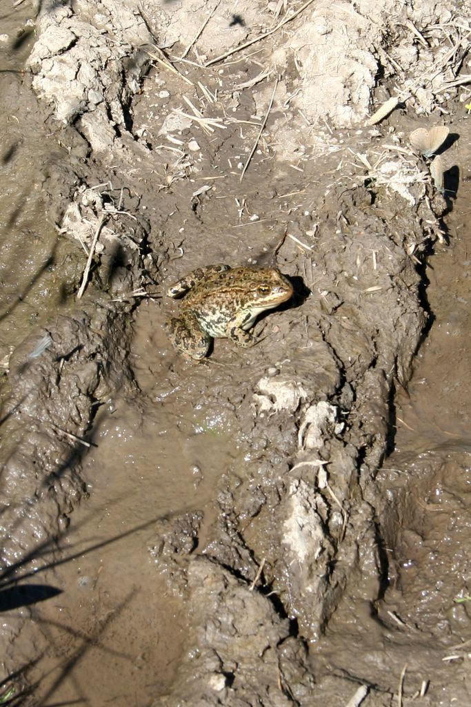
A frog...


Shauna and a big Douglas Fir...

It was lunchtime when we finally got back to the truck, so we decided to make for Tower Falls and see what sort of grub could be found there (our peanut butter and granola sandwiches we had made for the hike didn't sound nearly as appealing as one might think), and plan the rest of the afternoon.

Near Roosevelt, a group of about ten riders crossed the highway on horseback, and Shauna casually mentioned that it looked like a lot of fun. About a mile further down the road we spotted a stable next to a corral, and a big sign advertising horseback tours. We pulled in, checked it out and made reservations for the next morning. So Much for Shoshone Lake and the Lewis Channel Trail, I guess.

Over hotdogs and large cokes, we began to realize that our itinerary resembled a death march...not a vacation. And while we weren't about to let ourselves become two more Yellowstone tourists whose only chance of seeing wildlife was by bumping into it on the road, we weren't going to let our little getaway become drudgery, either.

We decided that we'd play the rest of our time by ear...go wherever we felt like going, do whatever we felt like doing.

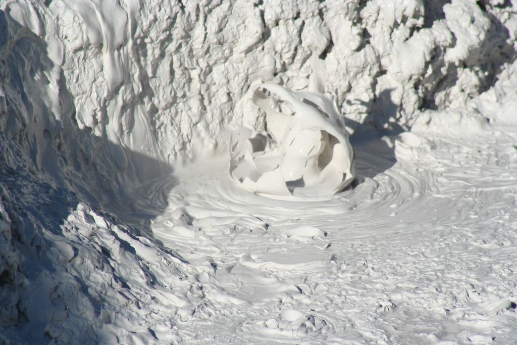
We left Tower Falls and headed north through Roosevelt, then east, for Mammoth, visiting a few of the thermal features in the area.


Mudpots South of Mammoth...


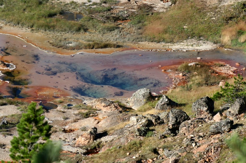
Hot springs...

A few miles south of Mammoth we ran into another, even bigger wildlife Jam. This time it was obvious what was creating the chaos. A big bull elk was making its way across an open glade a couple hundred feet off the road, bugling and scratching itself as it went. A few lame tourists got too close, though, and a park ranger made everyone clear out.


Instead of continuing south, we turned north again, through Mammoth, and out the north gate. We followed highway 89, along the foothills of the Absaroka range, into Lewiston, Montana. I’d never even heard of the Absarokas before this little diversion. They’re one of the most spectacular ranges in the western United States…one part Sawtooths, one part Tetons. I suspect they’re a local secret, like the Uintas, or the Wind Rivers. We hope to check them out next summer.

From Lewiston we hopped on the 90 towards Bozeman. From Bozeman we took the 191 south, back into the park. It was getting dark, so we rolled into west Yellowstone for the night.

Stay tuned...we're just getting warmed up!

Sunday, November 05, 2006

In Utah, the Wasatch Mountains get all the love...and why not? These peaks stand above the populated Valleys of Northern Utah like giant sentinels, forming a nearly impenetrable wall to the east, protecting its inhabitants from secular influences and invading ideologies for generations. They're ever present, timeless, a symbol of strength and persistence to those who live in their shadows. I imagine when most native Utahns think "mountain" they envision one of the many rugged peaks of the Wasatch Range.

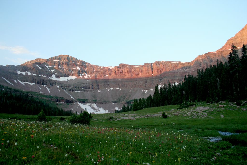
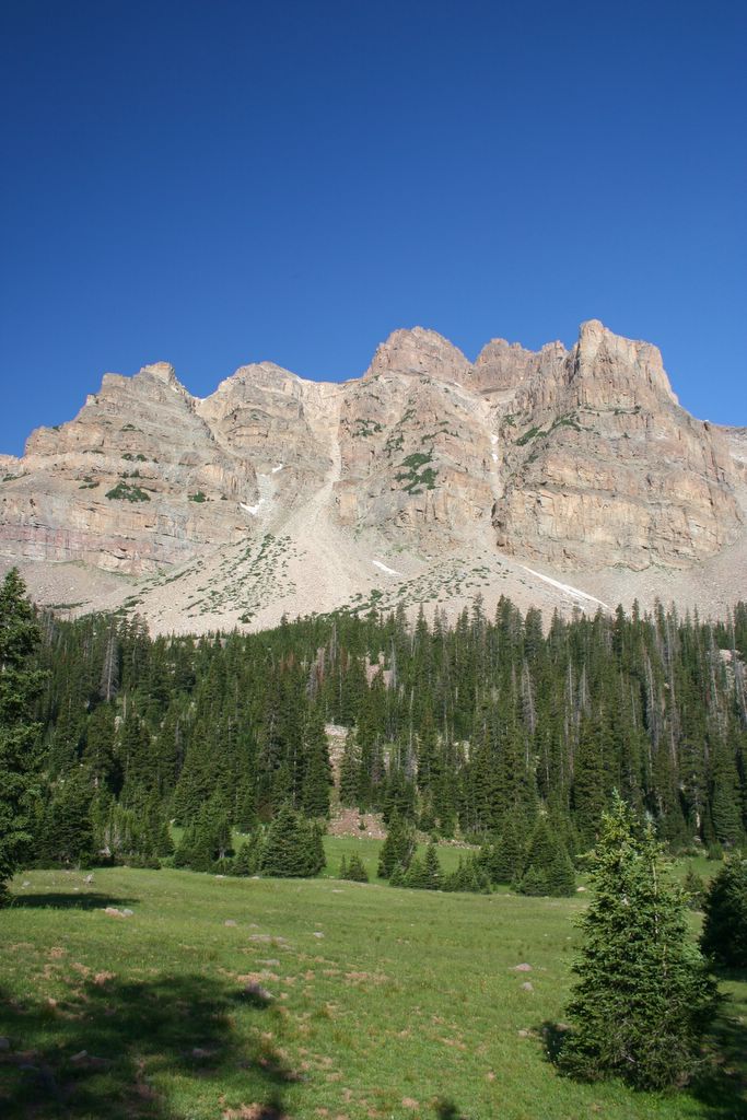
For all its grandeur, though, the Wasatch is but a pretender to the throne of the Utah high country. The real kings of the mountains are the High Uintas. Bigger, taller, better looking than the Wasatch, they're home to a much more diversified plant and animal community than any other Utah mountain range. Best of all; they're still relatively undiscovered, thousands of square miles lie untouched, unexplored by the masses. Carved by glaciers, its high valleys are dotted by literally thousands of clear, frigid lakes; the last refuge of the Bonneville Cutthroat Trout.

I spent a lot of time in the Uintas as a boy scout; hiking, camping, fishing, blowing stuff up, lighting things on fire...you know. Despite having grown up in Utah, though, my wife had never been properly introduced to the place. Every summer we would plan a High Uintas adventure, and every year something would derail us. Finally, fates conspired last July, and we found ourselves motoring down the Mirror Lake Highway towards the North Slope, and Alsop Lake.

I'd never been to Alsop Lake, so neither of us really knew what to expect. We'd been told that it was a moderate 9 mile hike (one way) through a lush alpine forest, to one of the most spectacular glacial lakes on the planet. We planned on hitting the trail about 10:00am, hiking through the afternoon, and arriving in time to set up camp and catch our dinner in the lake before sunset.

Pulling up to the Trailhead we very nearly turned around without even stopping. Our sources had failed to inform us that a fire had rolled though fairly recently, and that the place had been burnt to a crisp. Though the low vegetation was starting to rebound, and wildflowers were exploding across the whole scene, I wasn't even remotely interested in hiking 9 miles each way through a stick forest.


Charred trees near the trailhead...

We couldn't see far enough down the narrow valley to gauge the true extent of the burned area so we threw on our packs and agreed to hike in about a mile or so. If the scenery didn't improve in that distance we'd turn back and make for home before the day was completely shot.

Another Uintas trip foiled?

Fortunately, we reached the edge of the main burn area about 3/4 of a mile down the path and we followed it through large stands of lodgepole pine and across verdant meadows overrun with butterflies and wildflowers. It was flat, easy hiking along the East Fork of the Bear River and we stopped a couple times to splash our faces with the icy, clear water.

The trail took us past some cool abandoned homesteads, and fantastic views of Beulah Peak opened up as we started to gain a little altitude. We made great time along the valley floor, arriving at the 4 mile marker much earlier than we'd anticipated. We'd barely spent an hour and a half on the trail and we were already almost halfway to the lake. Seeing as we had time to spare, we took off our packs and rested for awhile before hitting the trail again.


Beulah Peak...

From the four mile marker the trail to Alsop Lake forks left, off the main path, and immediately begins ascending a series of moderately steep switchbacks to a waterfall nearly a mile above. A few hundred yards into it we began to realize we'd packed way, way too heavy for any sort of extended climb. We were loaded down with stuff we simply didn't need; extra clothes, a heavy four season tent, our three season sleeping bags (god knows we weren't going to trust in Slumberjack again!), thick ground cover pads, fishing poles, a bunch of tackle, a six pack of Spaghettio's (my favorite camping food)...holy crap!

We were both feeling it when we arrived at the waterfall. Not only were our packs heavier than lead, the air suddenly seemed much thinner here. I was starting to feel a little weak, a little nauseous, and Shauna thought I might be dealing with a little altitude sickness. I chalked it up to exertion and continued climbing.
About a mile past the waterfall the scenery got completely ridiculous. I've hung out in just about every national park in the west, but none of them have anything on this place (I don't know why its not a national park, or at least a state park yet). 13,000 foot peaks tower above you on both sides, and the trail climbs gradually through unbelievable alpine meadows and forests. Amazing...except that I couldn't stop puking my guts out!

I was hammered. I suddenly had a splitting headache and my legs felt like jello. I'd never had so much as a touch of altitude sickness before, and I had a hard time believing that's what it was. Especially since Shauna wasn't showing any tangible effects.


Shauna...

Needless to say, the rest of the hike was an exercise in misery. It took us nearly four hours to get from the waterfall to the lake, and another eternity to set up camp. I expected to start feeling better once I'd relaxed for a minute lakeside, and after I'd gotten myself re-hydrated. Wishful thinking. If anything I was feeling worse. My only consolation was that Alsop Lake was every bit as beautiful as we had been told it was; clear, cold, and we could see monster cutthroats cruising the shallows for flies.


I mustered enough strength to lay by the shore and fish for awhile, but only Shauna caught anything.

After that I laid down in the tent and didn't stir till morning.


Alsop Lake at twilight...

Shauna awoke before dawn, apparently roused by a large animal in camp. Unable to go back to sleep she packed up most of our crap and took a few pictures in the half-light.


The wildflowers were everywhere...

We'd planned on spending the morning hiking, taking some photos of the lake from above, but I was no better off than I had been the night before. My head was still pounding and the thought of breakfast made me want to spew. I was starting to buy into Shauna's altitude sickness theory. We were, after all, about 11,000 feet above sea level. I'd heard of people getting sick at lower elevations. We decided it would be best to just make our way off the mountain.

I wish I had been feeling better because the morning was perfect. The sun was shining and the mountains gleamed as we passed.


The Cathedral...

We made it to the waterfall a lot faster than it had taken us to hike the same stretch the day before, and my headache seemed to subside as we dropped down the switchbacks into the lower valley. When we finally made it back to the car I was beat, but no worse for the wear. My weakness and nausea had passed, and my headache was mostly a memory.

In the end, all the puking and all the pain is mostly forgotten. All that remains is the memory of this fantastic place, and our short time there. Fortunately the Uintas and Lake Alsop are practically in our back yard...we'll be back again, and again.

Sunday, October 29, 2006

Wow...better than six months to finish a single trip report...pathetic!

Pathetic, that is, until one considers what we've been doing (or, more correctly, where we've been going) instead of updating our blog. From Moab to the Uintas, the Tushars to the Sawtooths, Yellowstone to Great Basin National Park, and finally England, Scotland and Wales...we've had an epic 2006. We've seen and done more cool things this spring, summer and fall than any other time of comparable length in our lives.

We're hopelessly backlogged here, but, winter is coming (and with it perhaps a little time to catch up). I look forward to it...

Sterling

Sunday, October 22, 2006

The last day and a half of our trip was a blur. From Sweet Home we raced along Highways 20 and 22 to Detroit, Oregon. We'd planned on taking NF-46 north from Detroit (through the high cascades) but a local insisted that the road was impassable.

Determined not to repeat our adventures on NF-11, we continued west on the 22 into the Willamette Valley and the little town of Sublimity. From Sublimity we headed north, to Silverton, through some of the most beautifully pastoral countryside we'd ever seen...rolling hills and green fields stretching from one horizon to the other.


The Willamette Valley...

Silverton was a sparkling little town, and Shauna fell in love with it as we sped down main street(it bums me out that we had to blow through so quickly). She still fantasizes about buying a house and living there someday. Not a bad daydream...we plan on taking a trip to check out the area next spring.


The Willamette Valley outside of Silverton...

From Silverton, we took a circuitous route north, through the Willamette Valley and up the western flank of Mt. Hood. The Sky had turned gray, and the summit was shrouded in clouds as we ascended. The sky cleared for just long enough near the top to snap a couple photos of the snow covered peak before moving on.


Mt. Hood...

We spent the last night of our trip in Hood River; an ultra-quaint little Victorian town on the banks of the Columbia River. The scenery from our room was completely ridiculous with views of the Columbia River Gorge and Mt. Adams out one window, and panoramas of Mt Hood out another.

The next morning we a raced down the Gorge, stopping only briefly at Multnomah Falls en route to Portland International. The falls and The Gorge were both amazing, and we would have taken a lot more photos if we hadn't been trying to catch a plane. We had seen so many spectacular places in so few days that we might have started to become desensitized to it all.


Multnomah Falls...

I'll admit to being a bit sad as I handed the keys to the Escape off to the parking attendant at the airport. We'd practically lived in the thing for 11 days. It had gotten us safely through some fairly hairy spots, and it had held up to everything that the road could throw at it. Hats off to ya' little Ford.

After checking our bags and wading through airport security, we had a few moments to finally decompress, reflect on what we'd seen and done before boarding. The Pacific Northwest had exceeded our expectations so thoroughly. From the Hood Canal, to Sekiu, to the Hoh rainforest and Kalaloch. From Astoria and Ecola State Park, to Cape Mears and The Willamette Valley. It was all so damn cool! And despite having seen so much I felt like we had barely scratched the surface. Though we were tired, ready for our own beds, we were busy planning our return trip before we had ever even left.

Tuesday, October 17, 2006

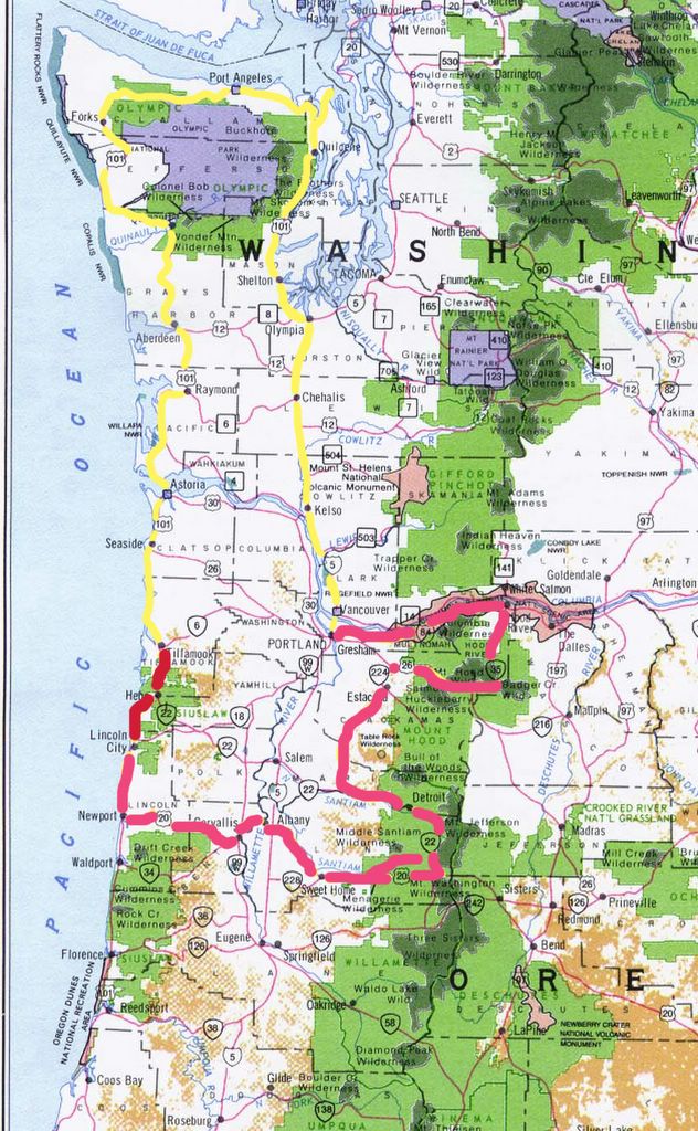
After visiting the Tillamook Air Museum (a post dedicated to just the museum is forthcoming), we began to realize just how much territory we had to cover in the short time remaining. The map below shows how desperate we had let our situation get. The Yellow represents how far we had gone in 8 1/2 days while the dark pink illustratess how far we wanted to go in about barely 2 1/2 days.


Clearly, if we wanted to see what we had planned on seeing, we'd have to fly. And fly we did!

We made record time from Tillamook to Newport, then from Newport to Corvalis. A few thoughts from the road:

1) The Oregon coast is a scenic wonder. It pained me to speed down it without snooping around a bit...without taking little hikes down to the surf, through the rainforest...without taking a few pictures.

2) The coast range is beautiful....reminded me a little bit of the Scottish Moorlands. Huge trees everywhere.

3) The Ford Escape V6 is a remarkably capable compact SUV. It felt solid even at very high speed.

From Corvalis we screamed across the Southern Willamette Valley and into the western foothills of the Cascade Mountains. The sun was setting as we rolled into Sweet Home, where we decided to stop for the night.

Sweet Home was an acid trip from the minute we arrived to the moment we finally escaped its dark, swirling vortex. Our first misadventure was simply trying to find a room. It seemed every motel in town was inhabited by semi-permanent residents, and without vacancy. One place was especially creepy...a small religious cult had settled in for the long haul, or so it would seem. There were clothes drying on lines in front of each of the rooms, and grubby children were running naked from door to door. There also appeared to be a disproportionate number of women to men...I saw several chicks, but only a couple guys. The whole setup gave me a very Charles Manson type vibe. They actually had a room if we'd wanted it, but we thought we'd look elsewhere. We finally found a place at the western end of main street, across from the A&W.

The next morning we glanced over our maps and decided to try a scenic route that also promised to cut significant miles and minutes off the day's drive. Instead of taking Highway 20 east to Highway 22 like normal (sane?) people, we elected to take Quartzville Drive, past Green Peter Lake, then take NF-11 to Highway 22. A fine plan indeed.

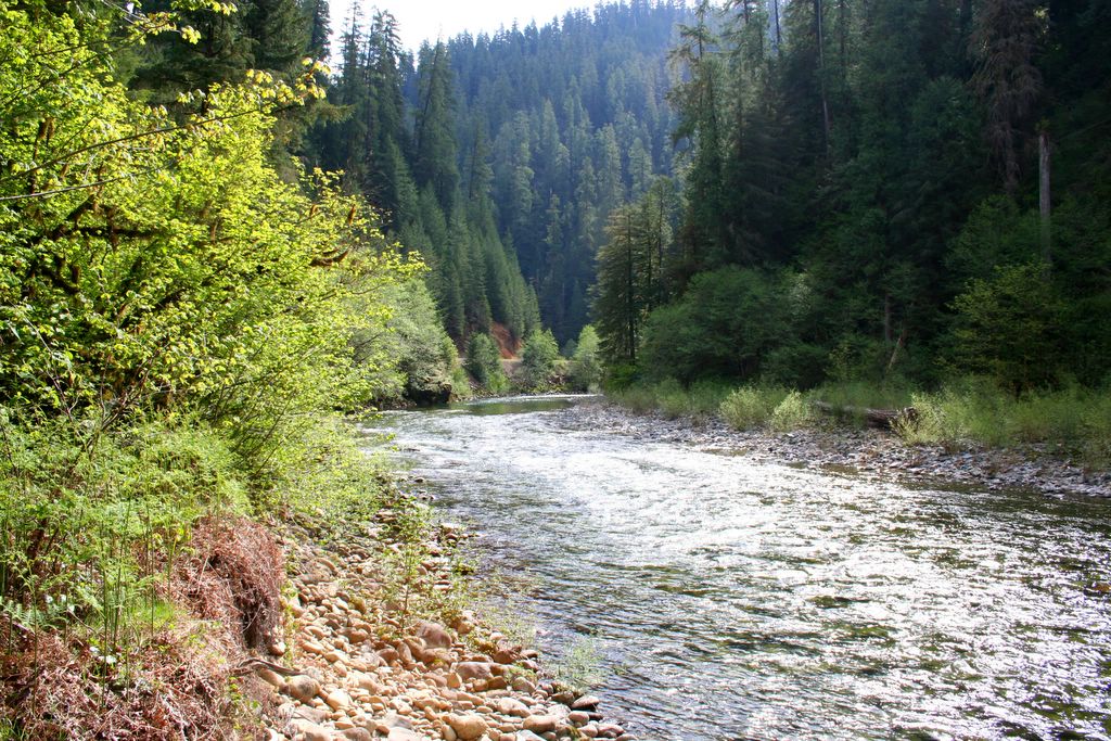
The scenery along Quartzville Drive was drop dead gorgeous, but it quickly became apparent that we weren't saving any time at all. The road was winding, and the lanes became narrower and narrower as we went. Soon, the route was little more than a single paved track, only one vehicle wide, with short pullouts every few hundred yards. We climbed steeply into the Cascades where we started having to ram tall snow banks that blocked our path. About 5 short miles from highway 22, the road came to an abrupt end where an avalanche had piled trees, rocks, and snow so high that nothing could pass. We tried getting around it in 4 wheel drive, but only succeeded in getting ourselves momentarily stuck. In the end we had to turn around and retrace our path some 35 miles back to Sweet Home.


Our only consolation was that we saw a whole lot of this...

Needless to say, I was pissed, and used up most of my yearly allowance of swear words on the drive back into town. There had been no signs warning that the road was impassible, and no indication on any of our maps that NF-11 was little more than a glorified game trail.

Sumbitches!

It was lunch time when we pulled into town and we grabbed a quick bite at McDonalds. The rental was covered in mud, so, we wolfed down a couple quarter pounders with cheese and made for a carwash I'd seen earlier.

Naturally, the change machine was out of order (we were quickly learning that very little worked as it should in this place). Undaunted, though, I walked to the A&W next door. I handed the guy at the counter a five spot and asked for as many quarters as he could spare. To my request he replied, and without further explanation "We don't give change on Sunday". Suffice it to say, I spent what little remained of my annual cuss word allowance right there.

We went from one end of that ruddy back woods hole to the other looking for enough change to run the wash. Finally, a strangely lucid gas station attendant (with a full compliment of teeth t'boot) dug a few dollars worth of quarters out of his own pocket, and out of his car for us. We are forever in his debt.

We finally managed to get the Escape looking a little more presentable, and we blew out of Dodge one last time. That is, until noticing that the gas light was on some ten miles down the road! Knowing we'd never make it to Detroit (Oregon) on fumes we turned around, yet again, for Sweet Home.


At this point we were starting to feel like the universe, or at least the black hole that is Sweet Home, was conspiring against us. Sucking us in. Fortunately the fill up was uneventful and we put Sweet Home in the rear view mirror faster than you can say "Deliverance."
We were even later stirring in Astoria than we had been at Kalaloch. The sky was gray, ominous for the first time since Portland, and the overcast made it a little tough to motivate. We'd been going pretty hard for a week and we were starting to feel it.

We had a quick brunch at the restaurant next to the Holiday Inn before hitting the 101 southbound. The overcast was starting to burn off a little, and the sun started poking holes through the clouds as we drove.

Tired of driving, we only got about 20 miles down the coast before deciding we'd had enough of the car. We pulled into a beach town called Seaside, parked the rental, and checked into the Rip Tide Hotel right on the sand.

We spent the remainder of the morning wandering through eclectic little shops on Seaside's main drag, and the afternoon beachcombing near the hotel. Finally, we watched the sunset over the Pacific, and then the fog roll up the beach from the shore. Not an altogether terrible way to spend a day.


Sunset at Seaside beach...

We got a much earlier start from Seaside than we had gotten at either Kalaloch or Astoria, and we headed South for Cannon Beach while it was still early. From Cannon, we drove up to a view point inside Ecola State Park (note: there's a small fee to enter the park). Apparently, much of The Goonies was filmed there, most notably the sequence where Mike discovers that the shoreline terrain matches the holes in the medallion they stole from the attic.


"Guys...I think I have a match...I'M SURE OF IT!"

From the parking lot we followed a steep trail through some fantastic old growth, down to Crescent beach. The place was beautiful, deserted, and littered with completely intact sand dollars and sea urchins. I guess the short hike is enough to deter most would be beachcombers, and the oceans bounty was everywhere.

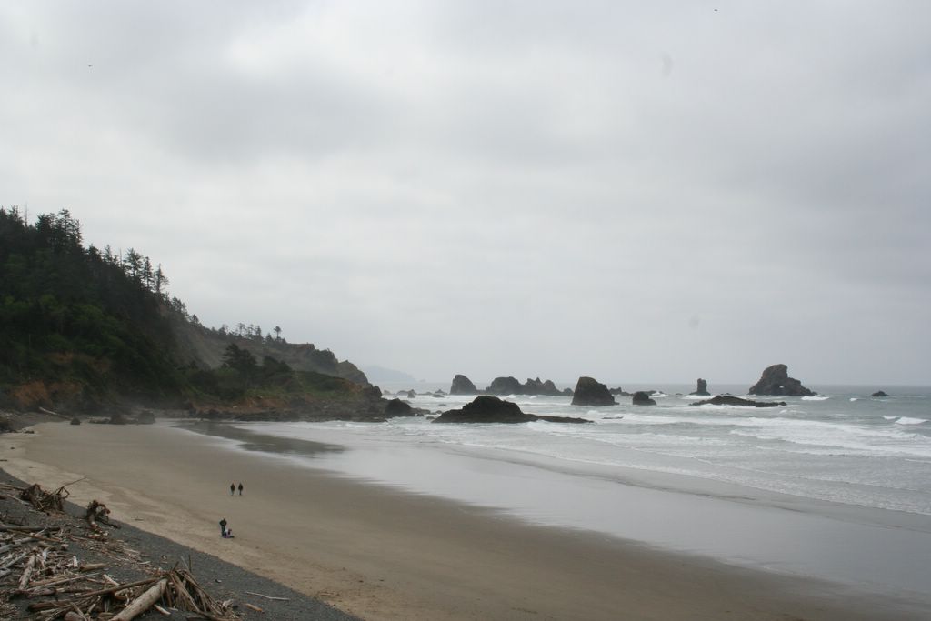
Eventually, we hiked back up to the view point, and drove to Indian Beach, scarcely a mile further into the park. Indian was significantly more crowded than Crescent had been (and needless to say, completely picked over), but just as beautiful. We had a good time scrambling over the basalt boulders at the southern end of the beach, and the tide pools between the rocks harbored some pretty interesting sea life (not quite as cool as Sekiu, or Ruby Beach, but cool nonetheless).


Indian Beach...


A light house just off Indian Beach...

From Indian Beach, we found our way back to the 101, and followed it down the coast to Tillamook. The drive was beautiful, amazing, and we took our time. Savoring every bend in the road, and each new scene as it unfolded.

From Tillamook, we took the Cape Mears loop road through Netarts, stopping in Oceanside for lunch. As you might have guessed from previous entries, I'm not typically a big fan of cities or towns. I prefer countryside and wilderness to streets and shops. Oceanside, however, is the rare exception. Perched delicately on a hillside above a pristine little cove, Oceanside's houses gleam like a hundred multicolored gemstones against the gray sky. If we could live in any of the little towns that we saw along Oregon's coast, we agreed it would be Oceanside.


Oceanside...

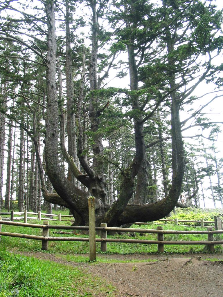
After lunch we continued on the loop road, visiting the Cape Mears lighthouse and the famous Octopus Tree (a Sitka Spruce with six huge skyward pointing reiterations instead of one main trunk) along the way.


The Cape Mears Lighthouse...


The Octopus Tree...

We also made a quick diversion to another very big Sitka Spruce, the Cape Mears Giant, before completing the loop in Tillamook.


Shauna and The Cape Mears Giant...

We left the Cape very impressed. There are a lot of cool things concentrated in a very small geographical area. Many of which we had to skip (we still had a long way to go, and only three more days to get there). This is another place we shall visit again.